Nautical Equipment
| 规格参数 | 参数值 |
|---|---|
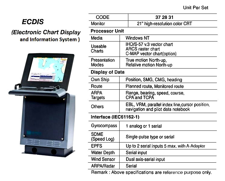
| IMPA编码 | 372831 |
| 产品单位 | SET |
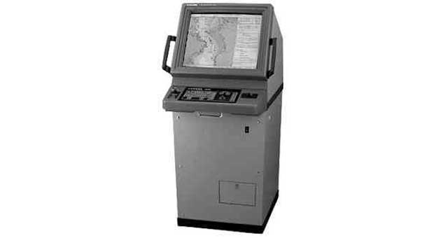
| 产品规格 | Required by IMO Resolution A.817 (19), IEC 61174, and related IHO (International Hydrographic Office) standards. ECDIS is a real-time geographic information system and accepted as equivalent to paper chart for continuous monitoring of the ship’s position using several positioning systems. It should be type-tested and approved by an official authority and should be used only together with official data and regular updates. Useable charts are derived from an official ENCs (Electronic Navigation |
| 中文汉化 | 372831 ECDIS(电子海图显示与信息系统) -----描述-----:符合国际海事组织(IMO)第A.817(19)号决议、IEC 61174标准及相关国际水道测量组织(IHO)标准的要求,电子海图显示与信息系统(ECDIS)是一种实时地理信息系统,已被认可可替代纸质海图,用于通过多种定位系统对船舶位置进行持续监控。该系统须经过官方权威机构的型式试验和认证,并且只能与官方数据及定期更新数据配合使用。可用的海图来源于官方电子航海图(ENCs)数据库。ECDIS能够显示电子海图、航线、ARPA雷达数据以及用户自定义信息,并支持船舶航线规划和全过程连续监控。系统具备精确的位置、水深、报警数据及其他预警功能,确保航行路线监控的可靠性,显著提升船舶航行安全性与操作效率,同时减轻操作人员的工作负担,相较传统纸质海图具有明显优势。该系统主要由显示器和处理器单元组成。如需了解更多详情,请联系当地供应商。 |
| IMPA版本 | Other Versions |
以上内容为AI翻译,请正确甄别-The above content is translated by AI and the images are sourced from the internet. Please discern correctly.